Upload | ||
The VAS Upload Architecture defines how soil data submitted by partners moves through the system from Excel-template submission, preprocessing, validation, and mapping into CeRDI’s Observation System, to publication through the VAS API. It ensures that all datasets conform to the ISO 19156 / OGC O&M model, enabling consistent ingestion and FAIR-compliant publication | ||
System Flow
|
| |
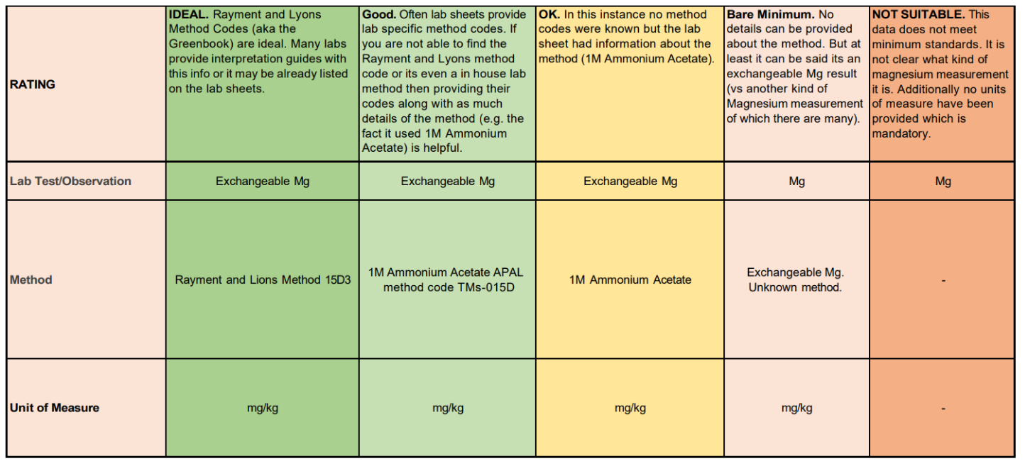
Validation | |
After upload, the Validation Process ensures that datasets meet technical and scientific quality standards before entering the live VAS Observation System. It combines automated checks, schema enforcement, and manual curation to guarantee interoperability, FAIR data compliance, and accuracy. | |
System Flow
|
![]()
![]()
02 4921 5473
enquiries@soilcrc.com.au
CRC for High Performance Soils
Level 1, IDC Building
University of Newcastle
University Drive
Callaghan NSW 2308
Australia
![]()
03 5327 9314
cerdi.admin@federation.edu.au
Suite 15, Greenhill Enterprise Centre
Ballarat Technology Park
University Drive, Mount Helen