Soil-moisture and temperature probes from different stream data to VAS through secure telemetry. Each probe’s time-series is harmonised in CeRDI’s collector and validated before public display. Users can view profile “bucket” readings, rainfall, and temperature through an interactive interface with verified and unverified sensor filters. |
System FlowAcquisition → Ingestion → Validation → Visualisation |
Sensor Data Acquisition Sources Sources: Sensors from Southern Farming Systems (SFS), Agriculture Victoria, Mackillop Farm Management Group (MFMG), and other regional networks. Telemetry: Data are transmitted via third-party services such as Adcon and Wildeye, then harvested by CeRDI systems. Types: Soil moisture, temperature, rainfall, and derived indices (e.g., plant available water).
| 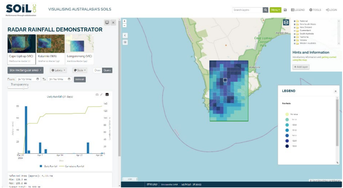 Figure: Screenshot from the Rainfields demonstration site Figure: Screenshot from the Rainfields demonstration site
|
Data Ingestion & Harmonisation Sensor data streams are imported into CeRDI’s Multi-Provider Probe Collector, replacing fragmented legacy import scripts. Built using Laravel + TimescaleDB, it supports efficient time-series storage and live aggregates. A token-secured REST API exposes endpoints to list devices, sensors, observed properties, units of measure, and to retrieve or export observations (CSV ≤ 500 k rows). API Examples: POST /api/login – Create token
GET /api/devices/list – List devices
GET /{provider}/observations/device/{id}/list – Retrieve time-series
GET /{provider}/observations/export – Download CSV
| 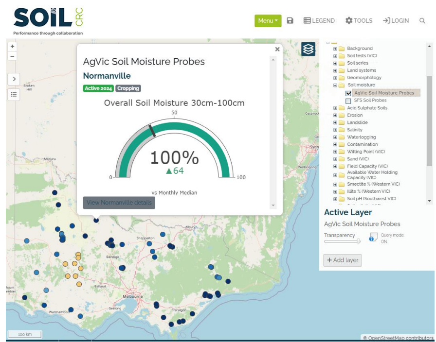 Figure: Agriculture Victoria’s soil moisture probes in the VAS portal (8 August 2024). Figure: Agriculture Victoria’s soil moisture probes in the VAS portal (8 August 2024).
|
Validation & Quality Controls: The system distinguishes: Automated checks detect inactive probes, stale data, inconsistent naming, and calibration errors. Manual review ensures only approved streams appear on public maps. Visualisation & Portal Integration Users can overlay rainfall fields, probe locations, and temperature data, filter by provider, network, verification status, and date range, and access summary statistics for each site. These visual elements provide an intuitive overview of real-time soil-water dynamics, supporting decision-making for researchers, farmers, and environmental managers.
| 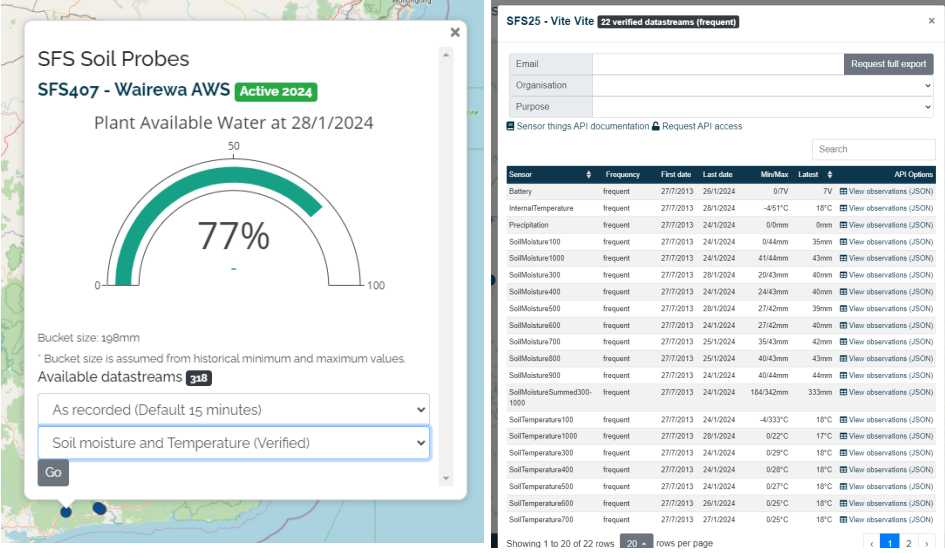 Figure: An example of the interface using verified data. Figure: An example of the interface using verified data.
|
API AccessThe soil moisture probes section uses a REST-based architecture to expose sensor readings, metadata, and device information securely. Access is governed by API tokens that define the scope and ownership of datasets. Core Endpoints: |
Endpoint | Method | Description |
|---|
/api/login
| POST
| Generates API token for secure access |
/api/devices/list
| GET
| Returns list of all registered devices with location and status |
/{provider}/observations/device/{id}/list
| GET
| Retrieves time-series data for a specific probe |
/{provider}/observations/export
| GET
| Exports validated readings (CSV ≤ 500,000 rows) |
/api/sensors/list
| GET
| Lists available sensors and their measured properties |
Example Response (JSON) {
"device_id": "SFS_204",
"location": [-38.255, 143.490],
"observed_property": "Soil Moisture (0–10cm)",
"unit": "v/v",
"timestamp": "2025-10-28T06:00:00Z",
"value": 0.34,
"provider": "Southern Farming Systems"
}
|
Data SourcesThis section unifies live soil and climate data from key regional networks: Southern Farming Systems (SFS), Mackillop Farm Management Group (MFMG), and Agriculture Victoria, along with other CMA and private providers (Adcon, Wildeye). | |