Rainfall Mapper is a demonstration tool within the Visualising Australasia’s Soils platform that provides access to rainfall data mapped across selected areas and time periods. The tool uses rainfall information derived from the Bureau of Meteorology’s Rainfields3 product, allowing users to visualise historical rainfall patterns at a 500 m grid resolution.
Unlike traditional rainfall gauges, which measure rainfall at a single point, Rainfall Mapper helps users explore how rainfall can vary across a broader area. This makes it useful for understanding local rainfall differences across paddocks, farms, catchments and regions and offers a reliable estimate of the distribution of soil moisture in the soil at the sub-paddock scale.
The tool was developed from the research outcomes of Soil CRC PhD graduate Dr Peter Weir, with development support from the CeRDI technical team. It supports VAS by extending the platform beyond soil datasets alone, allowing rainfall information to be viewed in ways that can be connected to regions, soil types and land management questions.
For more detail about the data source, technical processing and Rainfields integration, visit the Rainfields page in the VAS Technical Build section.
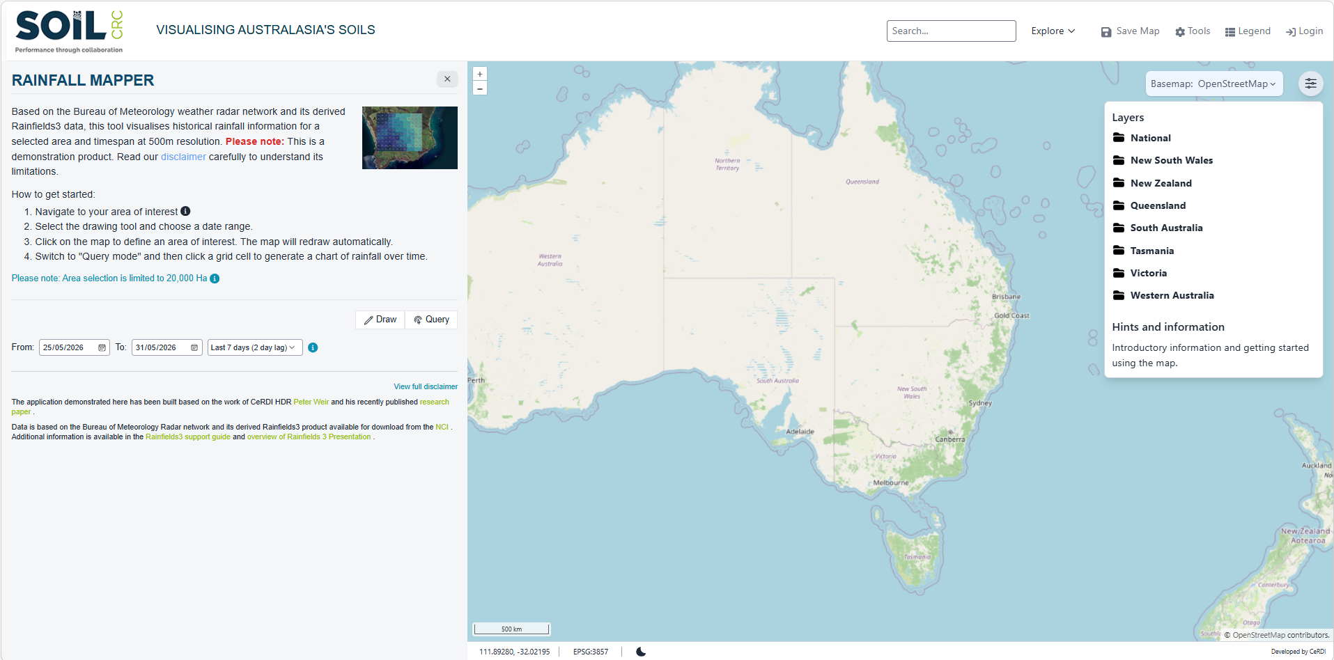
Please Note: This is a demonstration product. Read our 'Disclaimer' carefully to understand its limitations and consider the tool’s current data coverage, processing lag, radar limitations and area selection limits when interpreting results.
![]()
![]()
02 4921 5473
enquiries@soilcrc.com.au
CRC for High Performance Soils
Level 1, IDC Building
University of Newcastle
University Drive
Callaghan NSW 2308
Australia
![]()
03 5327 9314
cerdi.admin@federation.edu.au
Suite 15, Greenhill Enterprise Centre
Ballarat Technology Park
University Drive, Mount Helen