To demonstrate this, a localised thunderstorm with intense rainfall was measured by the Rainbow weather radar located in the Wimmera / Southern Mallee, Victoria, on the afternoon of the 7th of January 2022.
| ||
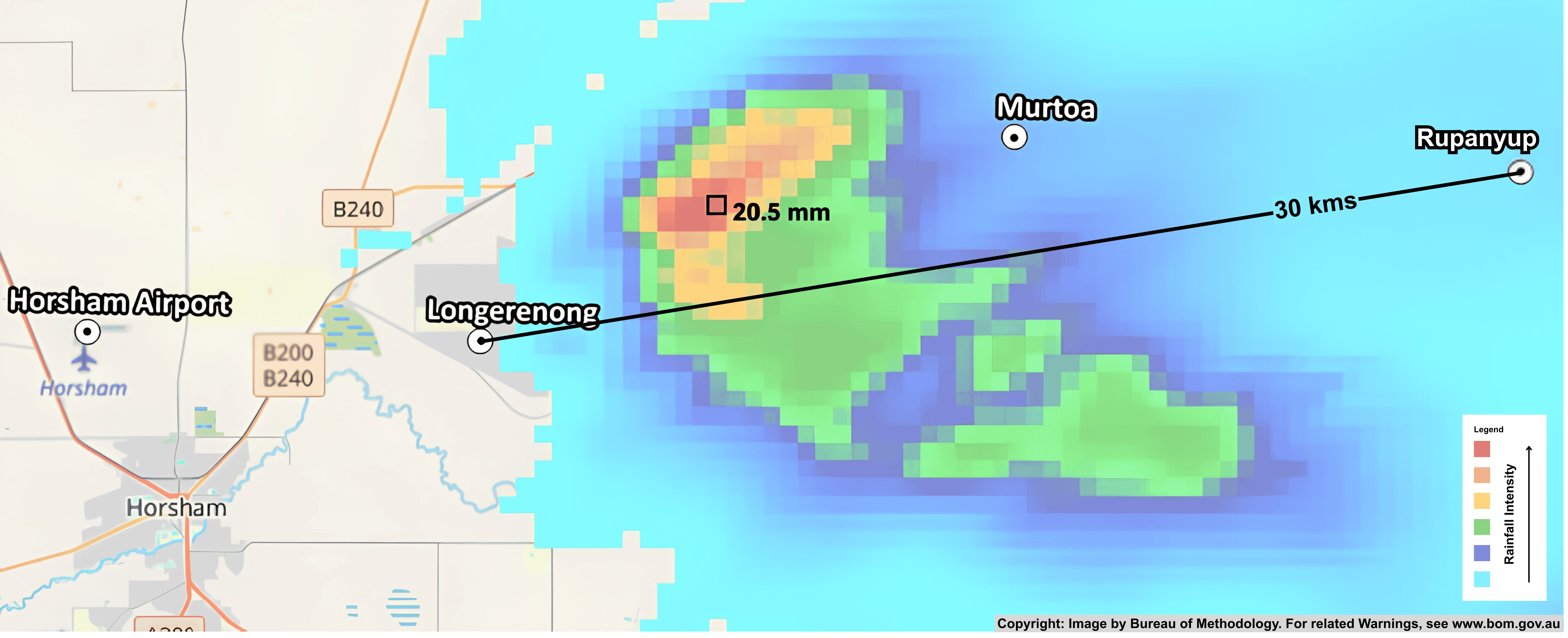
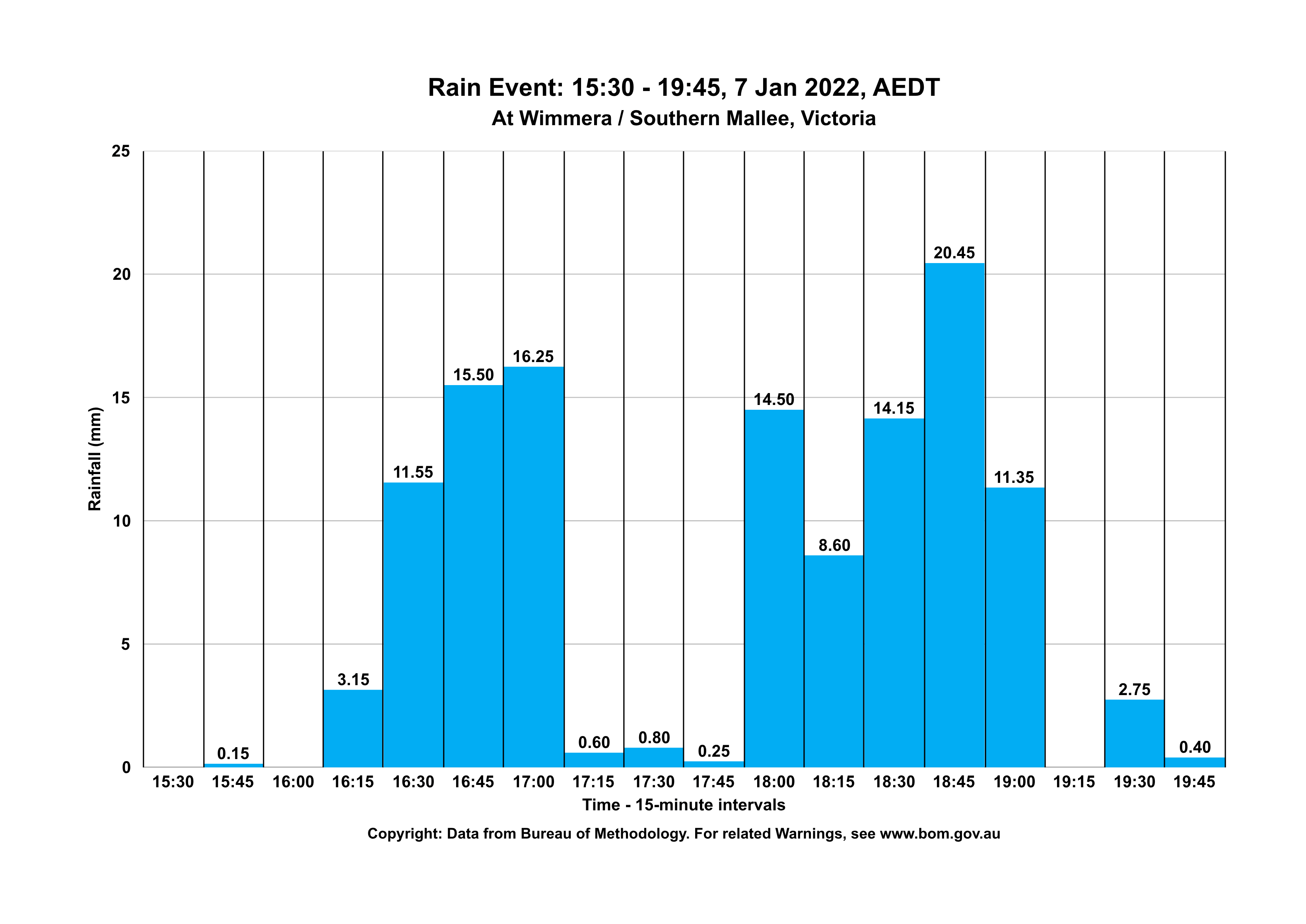
The thunderstorm was located between the towns of Longerenong and Rupanyup, approximately 30 kms apart. The peak rainfall intensity for a 500 m x 500 m tile recorded by the weather radar was 20.45 mm in one 15-minute interval |
| |
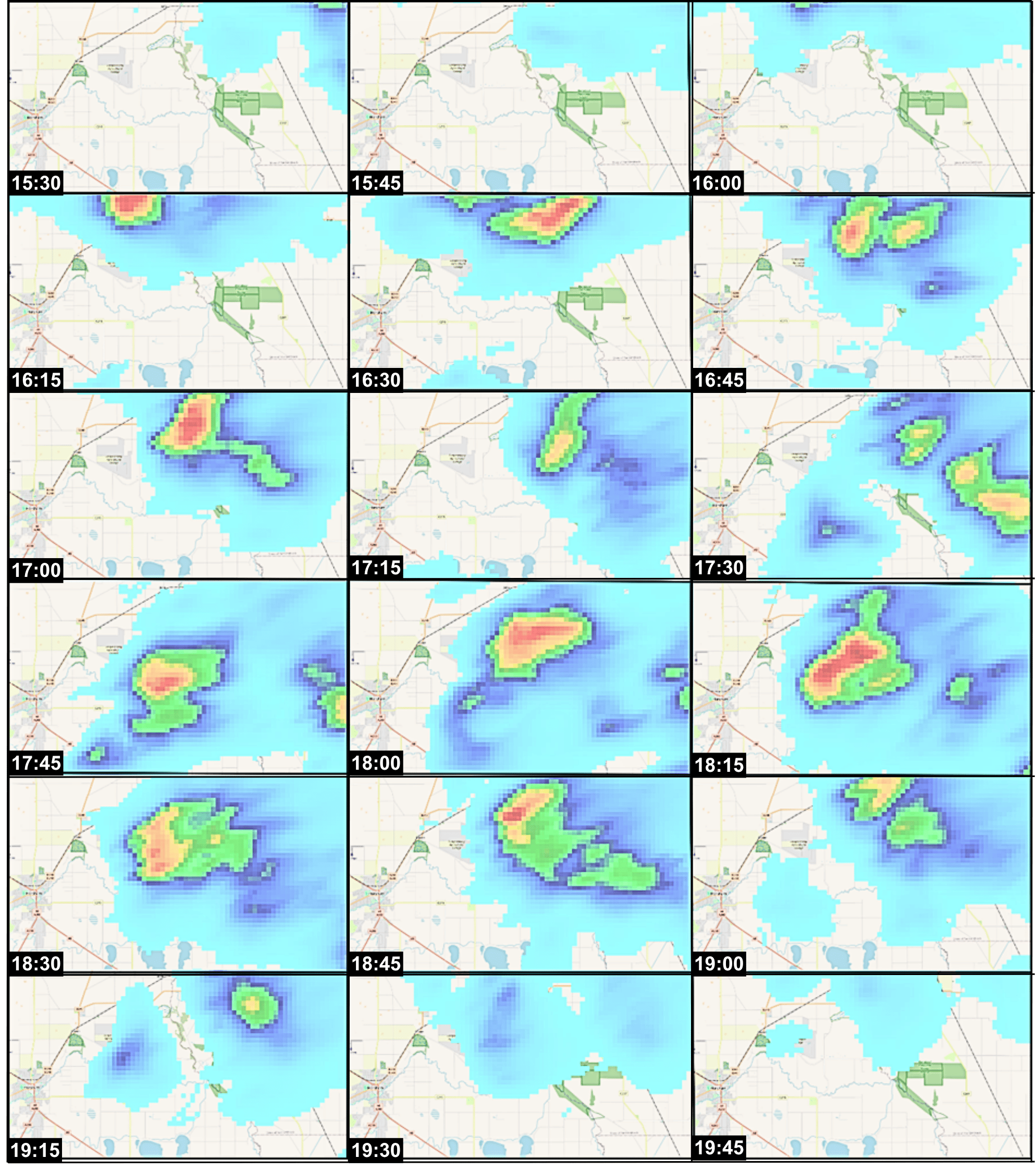
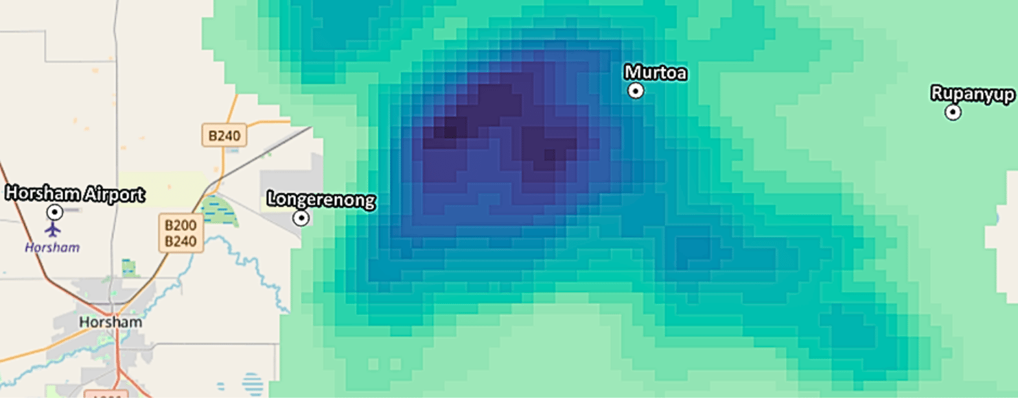
The thunderstorm moved through the region as shown in the time sequence of Rainfield3 precipitation data at 15-minute intervals as measured by the Rainbow weather radar. |
| |
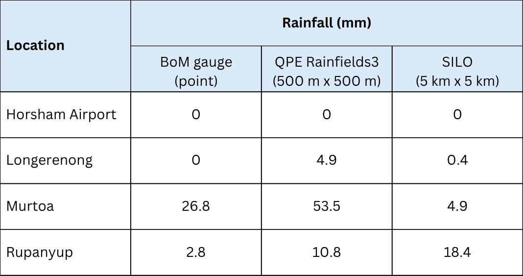
The limited areal distribution of the rainfall meant that the spatial extent of the precipitation in this event was not entirely recorded by the four official BoM rainfall gauges in the region. The record for the daily rainfall collected in the 24 hours prior to 0900 8th January 2022 AEDT (that is, the day of the storm), is shown in the table below, compared with the radar data and the widely used rainfall map (SILO). |
| |
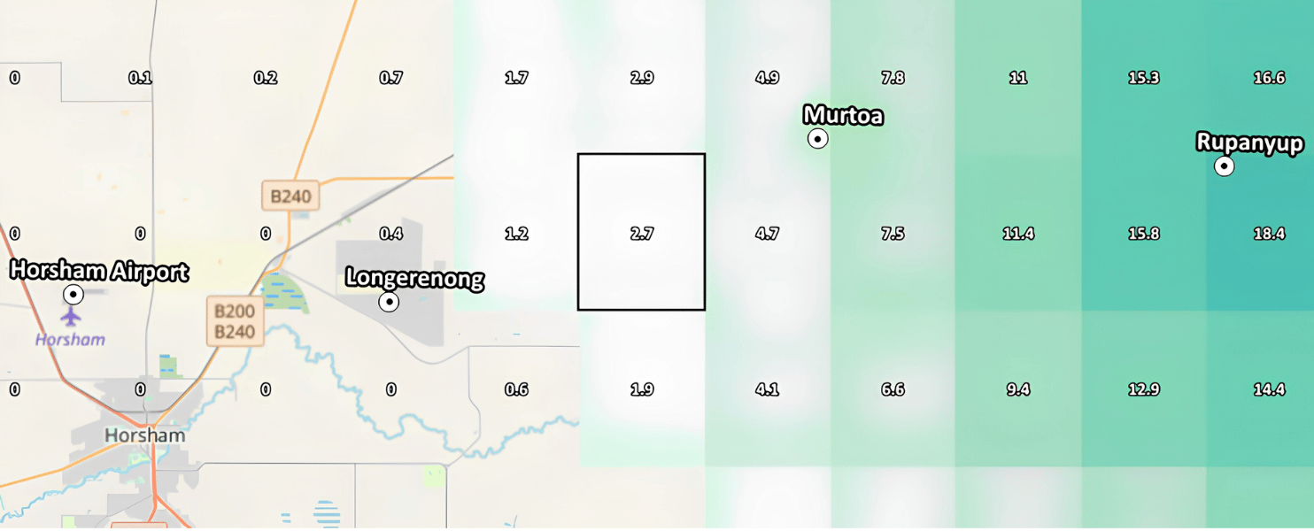
| SILO (Scientific Information for Land Owners – Queensland Government) maps the rainfall in 5 km x 5 km grid tiles, modelled using the daily rainfall amounts recorded at the gauges to 9 am on 8th January 2022. The grid cell (beside) and highlighted records daily rainfall of 2.7 mm. SILO is often used to get the input values used in models, such as water balances, rainfall-runoff models, soil water models, pasture growth and crop models. | |
By comparison, Rainfall Mapper provides a much more accurate map of the daily rainfall amounts resulting from the thunderstorm with 500 m x 500 m tiles of daily rainfall amounts to 9 am on 8th January 2022. |
| ||
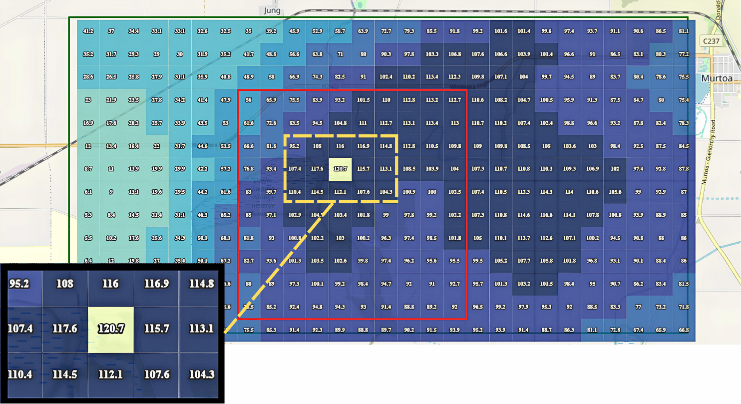
Closer inspection of Rainfall Mapper displays 500 m x 500 m tiles of daily rainfall ranging from 56 to 120.7 mm. The red rectangle depicts the corresponding SILO tile with a daily rainfall value of only 2.7 mm, highlighting the limitation of SILO gridded data to represent daily rainfall values, especially in areas experiencing localised, intense thunderstorm activity.
Next Example: Example 2 - VIC - Feb'26
![]()
![]()
02 4921 5473
enquiries@soilcrc.com.au
CRC for High Performance Soils
Level 1, IDC Building
University of Newcastle
University Drive
Callaghan NSW 2308
Australia
![]()
03 5327 9314
cerdi.admin@federation.edu.au
Suite 15, Greenhill Enterprise Centre
Ballarat Technology Park
University Drive, Mount Helen