About the data
The soil data in the VAS is made up of two main sources:
Publicly available soil data from open repositories, such as the Australian National Soil Information System (ANSIS), and data that has been made openly available by the data custodians, such as the Soil Health Knowledgebase. Since there are over 1600 open datasets with an unknown number of data sites, samples and observations it is not possible to display them all. Those that are on the on the VAS portal are merely a selection of what is available in each state. In general, the selection of data has been made in locations where the project participants are based. Most of these data are accessed interoperably, and therefore the links may not always work.
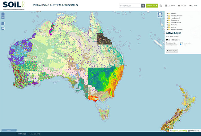
Private sector soil data uploaded and managed by the project participants which is visible to them via a login, but not publicly available unless they have chosen to share some or all of it. In mid-2024, there are around 40 datasets contributed by ten farmer groups, three catchment managers and one university. This results in approximately soil data from 2891 sites, with 9788 samples, and 200,707 observations. Datasets continue to be added by project participants through the self-serve system before being mapped into the VAS portal for users to access.
The soil data also includes soil moisture sensor data, some of which has been made visible to the public (https://data.soilcrc.com.au/vas_map.php?view=27632_7249da3&map=85).
