Map portal
Discover and share soils data and information from Australia and New Zealand on the VAS data portal

Data catalogue
A collection of VAS Partner soil datasets where the data has been processed by the VAS team into a format which is consistent, well-structured, and FAIR
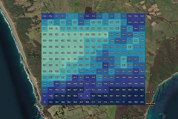
Rainfall mapper
Based on the Bureau of Meteorology weather Radar network and its derived Rainfields3 data, this tool visualises historical rainfall information for a selected area and timespan at 500m resolution
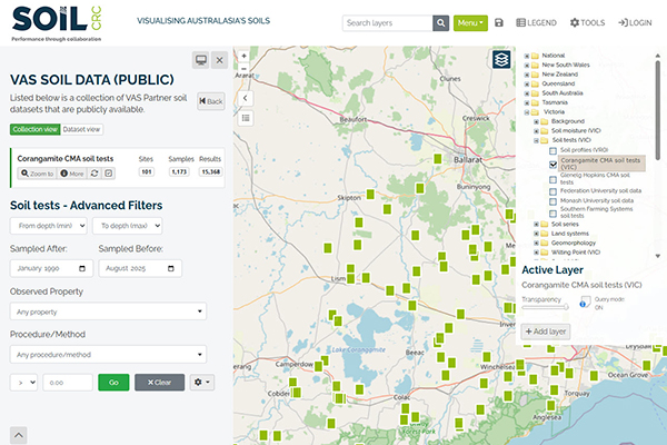
Public datasets
Information about the public datasets available through the VAS data portal
Research
How are we making sense of VAS? What do we know about how VAS is being used? Learn more about the research aligned with VAS and access key research outputs
User guides
Help and frequently asked questions are accessible by clicking the link in the Hints and Information section of the menu
![]()
![]()
02 4921 5473
enquiries@soilcrc.com.au
CRC for High Performance Soils
Level 1, IDC Building
University of Newcastle
University Drive
Callaghan NSW 2308
Australia
![]()
03 5327 9314
cerdi.admin@federation.edu.au
Suite 15, Greenhill Enterprise Centre
Ballarat Technology Park
University Drive, Mount Helen