Public datasets
The Soil CRC’s Visualising Australasia’s Soils (VAS) project delivers access to public and private soil datasets for use by the Australian agricultural industry. VAS contains 15,000 samples and 250,000 observations, collected between 1988 and 2024. It also includes over 800 million soil probe observations.
To visit the public datasets go to the following link - https://data.soilcrc.com.au/map/soils
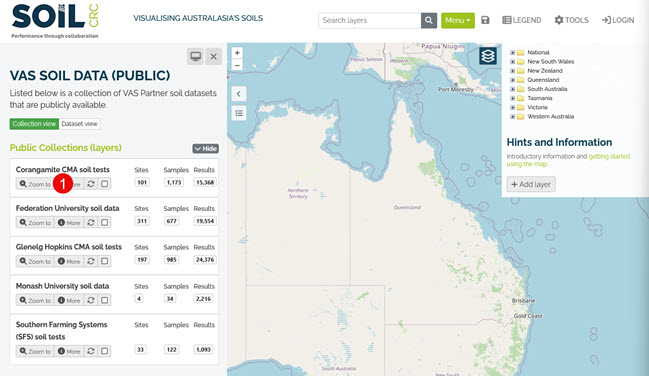
Then to get started click on the 'Zoom to' options for one of the 'Public Collections (layers)' (annotation 1 below). You can click on the green boxes to access soil data observations for a particular region. You can also click on the map legend to access over 200 data layers available across the country. Double clicking and dragging over the map you can locate a region and view the available soil tests. The dataset on the portal includes meta data for data descriptions, contact details, and licensing information.