Rainfall mapper
This demonstrator tool provides access to weather data mapped to regions and soil types across Australia. The data is based on the Bureau of Meteorology weather Radar network derived Rainfields3 data. Using this tool the historical rainfall information for a selected area, and timespan, mapped to 500m resolution can be visualised. Accessing rainfall data to a selected region provides a visual representation of rainfall patterns, highlighting variations in rainfall intensity over time. This Tool offers a reliable estimate* of the distribution of soil moisture in the soil at the sub-paddock scale.
The Tool was developed from the research outcomes of Soil CRC PhD student Dr Peter Weir.
To visit the rainfall mapper go to the following link - https://data.soilcrc.com.au/map/rainfields
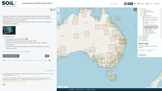
*Please Note: This is a demonstration product. Read our 'Disclaimer' carefully to understand its limitations.
